Hong Kong Travel

I’ve been doing a little blog post series on travel that’s mainly focused on the technology side of things. There was France, Japan, Switzerland, and now Hong Kong.
Planning Ahead
Drafts
Jason didn’t prepare a detailed itinerary for this trip like we had for the others so there was no Google Sheets document to deal with. I collected names of coffee shops, cafes, etc. as we watched travel vloggers on YouTube by just adding them to notes in Drafts. I used a tag to filter for the notes when it was time to incorporate them into a Google Maps list. Drafts is so nice.
Google Maps Lists
The Lists feature in Google Maps is indispensable at this point. I created a Hong Kong list, where I added the places from my Drafts, or any other place that seemed interesting, along with a note about the place to jog my memory about why it was included. Jason was able to collaborate and view everything in the list, and the way the list is visible on the map as little emoji dots is always helpful to see if something else you wanted to do is nearby.
Apple Maps Is Still For Planning
This isn’t breaking news at this point, but just like before, the Guides feature remains awful. You can’t collaborate, or do anything you can do with Google Maps Lists. The whole thing is still built under the assumption that you’re a publisher arranging a travel brochure.

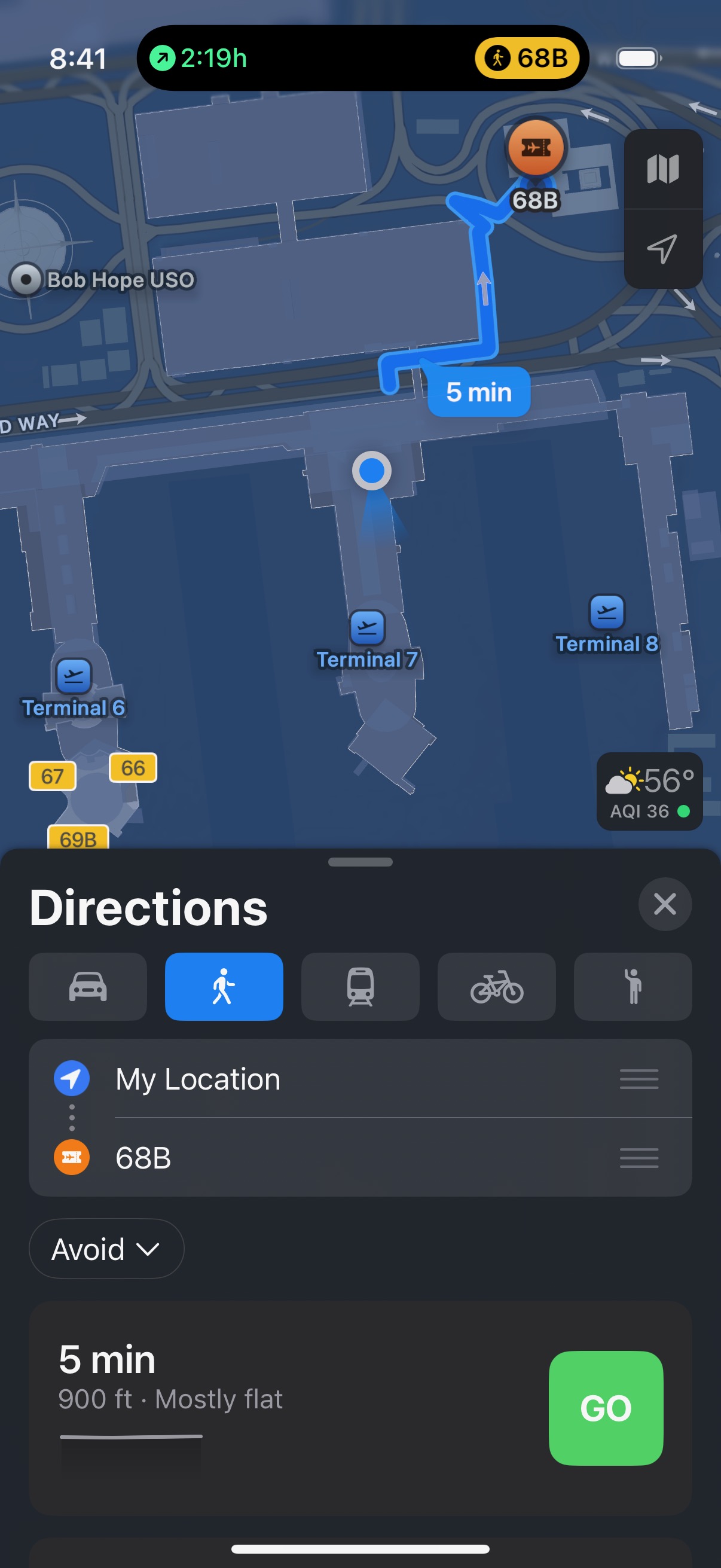
Also, every time I go to LAX I get a push notification about how I can “Explore a detailed airport map” but the other than zooming and panning the map can’t actually be used for any kind of navigation. Searching for gates does really bizarre stuff, but for some reason you can flip through a list of all gates? I don’t get it. If you can’t tell me how to move from my location to another location inside the airport than this hardly merits buzzing my wrist —once again. Google can’t do walking directions in the airport either, but it doesn’t send me push notifications claiming it can.
Mercury Weather
This is a must for any upcoming travel. It’s in my Smart Stack widget on my iPhone and when we start to get close to the travel dates I can see what the weather forecast will be in that other location to begin adjusting my expectations ahead of packing, or other considerations. I prefer Carrot to Mercury for my actual weather, but Carrot doesn’t offer a comparable trip feature.
Octopus
No, not the cephalopod, but the Hong Kong transit card. Like the transit cards in Japan, you can load up a transit card with money and then use it for everything from transportation to vending machines, or even restaurants. In fact, several restaurants we ended up going to would only take cash or Octopus.
Unlike Japan, you can’t simply add an Octopus card to your Apple Wallet and fill it up with money via ApplePay. Well, Apple has instructions that say you can, but Octopus requires a Hong Kong issued credit card for that. It has the most confusing error if you try to do this without a HK credit card in your Wallet because it says you need to add a credit card. I do have credit cards, of course, so this was a pretty bad error that the documentation doesn’t make very clear.
There is an Octopus for Tourists app — no, that’s really what it’s called. That app can be used with international credit cards to load up an Octopus card and then add that to your Apple Wallet, which you can then transfer to your Apple Watch. Remember that these cards have the ridiculous restriction of only being on one of your devices.
I used the Octopus for Tourists app, and I wasn’t phished, which was great. Jason, however, couldn’t get it to work for him with any of his credit cards. The Ocotopus for Tourists app has a pretty low rating in the App Store with many reviewers running into this, or other, issues.
We were a little concerned that only one of us had an Octopus card before the trip, but we were hopeful that he would be able to at least get a physical one when we got there.
Turns out, that we never did, because some of the turnstiles (all of the Star Ferry ones, and a couple per MTR station) take tap-to-pay international credit cards for fares. That would have been really useful to know before we messed with Octopus for Tourists, etc. I’m imparting this knowledge to you, dear reader. Just know that if you don’t get an Octopus card that you should plan on withdrawing some Hong Kong dollars to use on your trip for certain restaurants, etc.
Up in the Air
Flighty
All the flights go in Flighty. We were flying United, and United has done a pretty good job with Live Activities in their app. So much so that it’s not worth keeping both the Flighty Live Activity and the United Live Activity going at the same time. Each one does the silly thing were it counts down the flight time to the second. Sure.
Watch
I still wish that the Apple Watch had some understanding of the flight I was on. For the full duration of the flight it thinks I’m in Los Angeles, which is just absurd. On this trip I decided it would be best to set the Watch to Do Not Disturb and put it in Theater mode so I wouldn’t see the watch face. I wanted it to record data, but the notifications for standing reminders never come through at a good time, so why buzz my wrist for them?
Roaming
I’m still roaming when I travel. I’m too spooked to use eSIMs. Sorry if you think I should, or just want me to write about it, but I’ll continue to just pay a ton of money to not deal with it.
Apple Maps and Google Maps
Google still beats out Apple for us, most of the time, but I still give Apple Maps a try periodically while traveling. Having all the data in Google Maps because I used Lists for planning, means I’m more likely to use Google Maps.
Pedestrian Bridges
Both Apple and Google provide adequate walking directions in Hong Kong, but they could both be better about pedestrian bridges. Hong Kong Island has a ton of pedestrian bridges and in some cases they are the only way to cross at an intersection. Both maps apps show little stair step things and mention going up or down, but they draw the route as if it was a flat line, and a flat walk. This tripped us up a few times where we’d look at an intersection in a map app and then get there to find out we had passed the staircase entrance for the pedestrian bridge.
It was good that we were never truly lost, or stuck anywhere, but this could be better. My favorite shot classification in VFX is CBB - could be better. It’s good enough to be final if we can’t get something else in time. That’s certainly what both feel like when it comes to pedestrian bridges.
Ferry
The Star Ferry operates out of Tsim Sha Tsui on the Kowloon Peninsula and either takes you to Central or Wan Chai on Hong Kong Island.
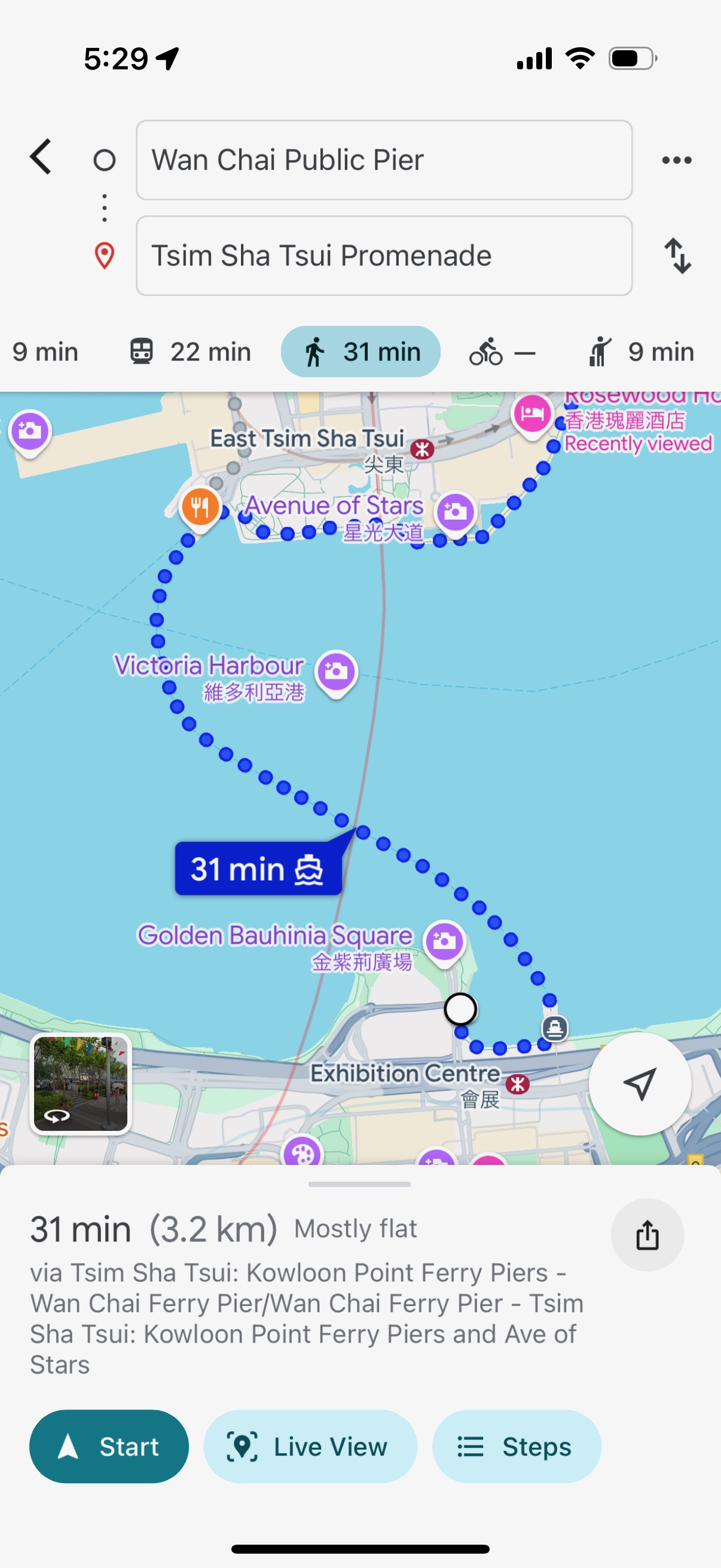
A curiosity of both Apple and Google Maps apps is that the Star Ferry is considered walking directions, not transit. If you put in a destination on one side of Victoria Harbor and starting point on the other, then both apps will show you walking across the harbor along a Star Ferry route. If you pick transit, both apps will show the subway (MTR) routes only.
The only other times I’ve taken a ferry have all been about getting to a ferry terminal and waiting, as if it was a train station or airport, so I’ve never seem it used like this. I couldn’t say if this was typical but it certainly wasn’t my expectation when I was wondering why the Star Ferry wasn’t showing up for routing in transit.
Because this counts as walking, it also doesn’t describe anything about the ferry fares in the app. Not that it should really expect anyone who thought they were going to walk across water that they needed to pay for that, but it’s just odd.
MTR
The metro subway system in Hong Kong is very, very busy –especially the Island Line— and the facilities are all much more like my experience in Tokyo than Paris, London, or New York.
Above ground, you have multiple entrances and exits that have an assigned letter and number. Every subway station has two kinds of turnstiles. Both types accept the aforementioned Octopus travel card (or virtual Octopus card), but there are usually only a couple that can accept tap to pay credit cards.
Because I had an Octopus card in my Apple Wallet on my Watch, I was able to use any turnstile. Unfortunately, because Jason didn’t have an Octopus card he always needed to look for the specific tap-to-pay turnstiles which were sometimes around a corner. Not a big problem, just something to be aware of when you’re in a big crowd of people rushing through the station.
There are numbered gates for entry and exit from the subway cars. Everything is very clearly labeled inside the station.
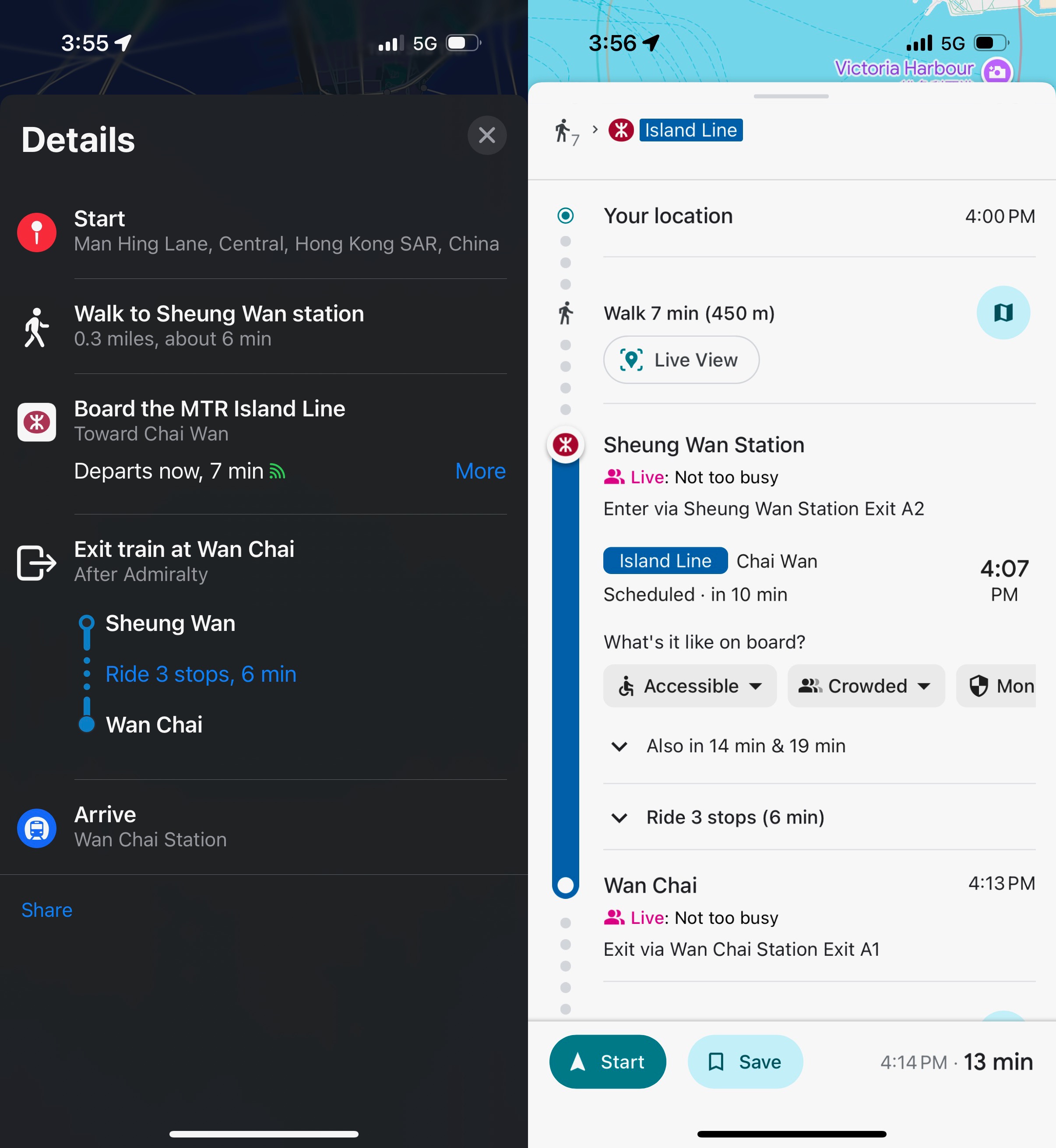
Google Maps still offers an advantage over Apple Maps where it says how crowded the trains are expected to be. Unlike Tokyo, Apple doesn’t integrate with the transit card to tell me about my card’s balance. A feature Google can’t compete with, but since it’s absent, it’s a win for Google.
Apple and Google still have the weirdest system for walking directions to and from transit stations. I really wish that it treated the train station interiors, and the walking direction portions, like it treats those types of directions in the walking mode. In transit mode it’ll show a path and say walk to the station. Simply walk to the station!
It’s a baffling choice, in all cities. On a few occasions I’ve set the destination as the train station for walking directions, then switched to transit directions once I got there, and back to walking directions when I exited the station. It should really be a seamless experience.
Reviews
This is still a major point of contention between me and Apple Maps fanboys. I prefer to use Apple Maps for CarPlay, and it’s great for walking directions on my Apple Watch, but when it comes to accessible location information while I’m traveling, Google Maps trumps it every time. It’s a good thing that Apple works with local providers, when available, to surface local review web sites. In Hong Kong, Apple works with OpenRice, and that’s a good thing for Hong Kong residents with iPhones.
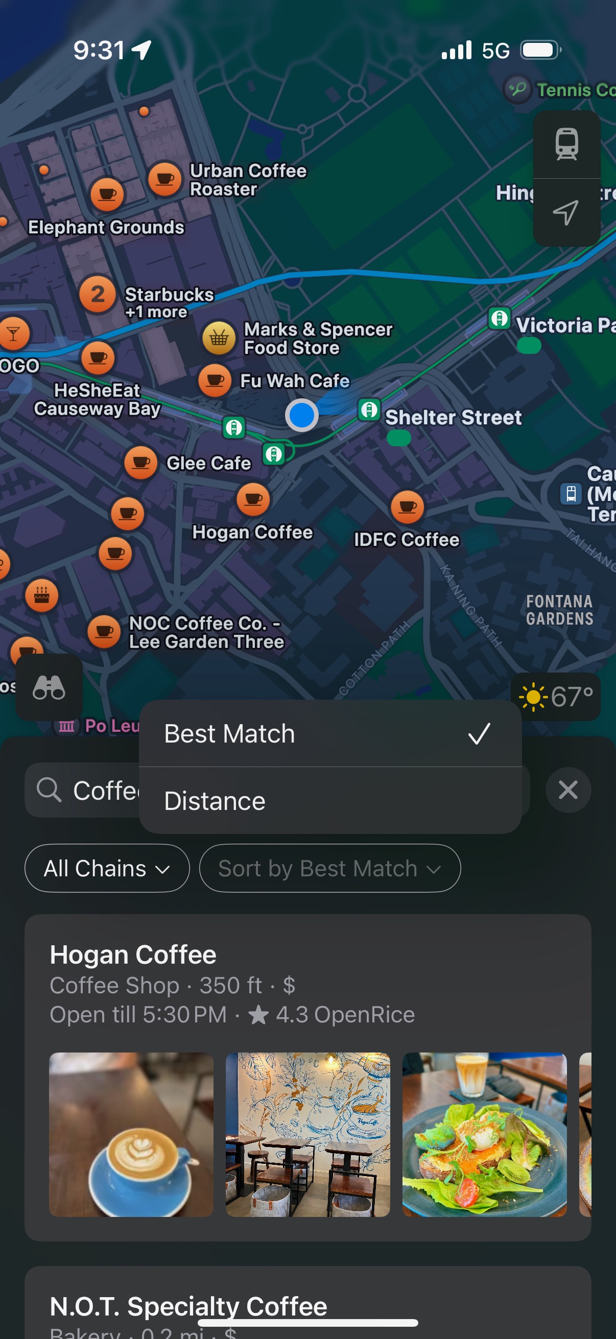
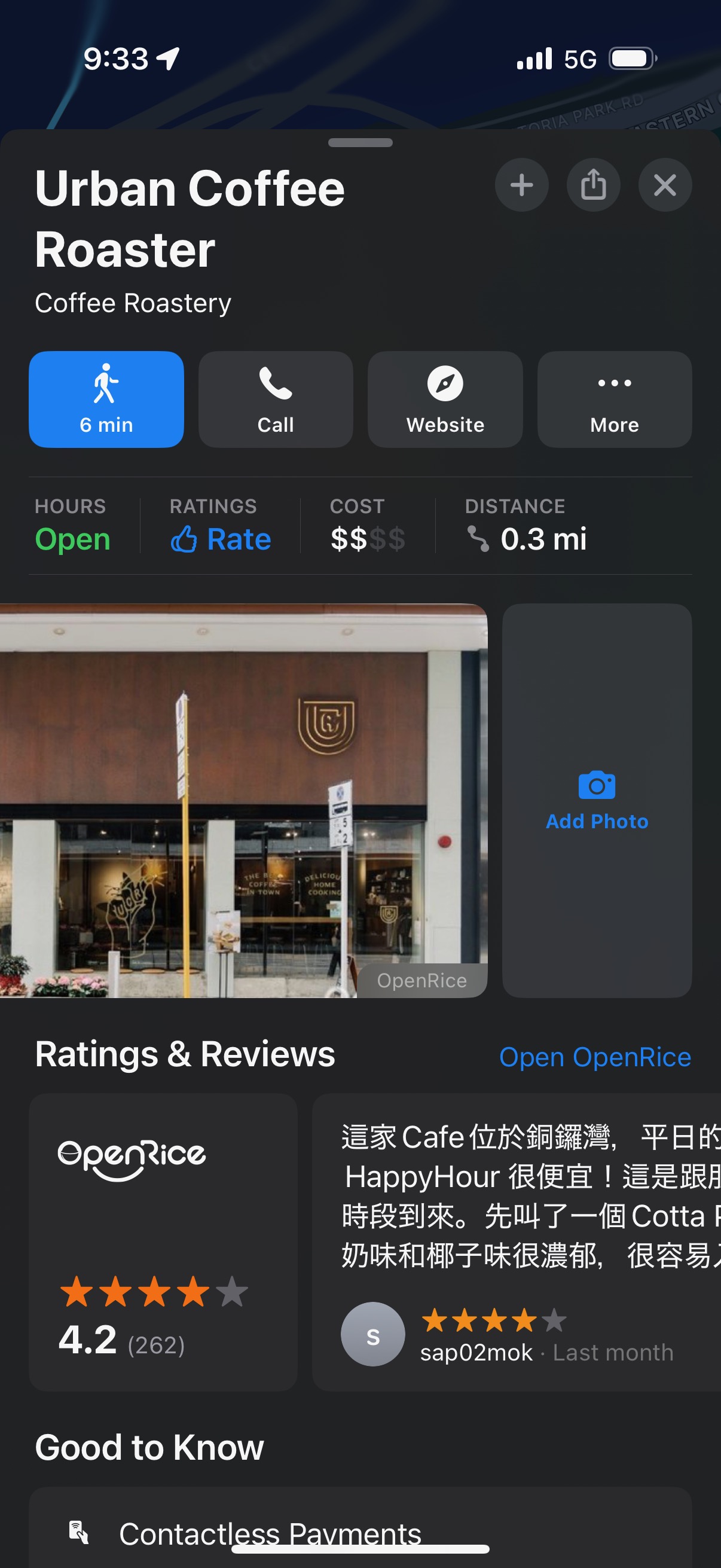
However, I am traveling, and there is a language barrier to reading OpenRice reviews that I can not easily get around. Just like I said in the Tokyo blog post. Unfortunately, it seems that because of something about how the OpenRice pages are encoded, I can’t translate the web page like I was able to do in Japan. OpenRice also has a very junky site full of pop-over web ads so it’s no fun to navigate around on either.
Apple still doesn’t offer the ability to translate a review inside of the Apple Maps app, despite showcasing that possibility in a demo app in the Translation API video from this past year’s WWDC. It’s a real shame.
Google, however, has a very accessible set of reviews for every location. Reviews aren’t just if a place is “good” or “bad”. I don’t watch movies based on their Rotten Tomatoes score.
I didn’t come across a single place that uses Apple’s absurd Ratings system in Apple Maps. In Switzerland that was infrequently, and unreliably used. If Apple is accumulating any kind of useful information from Ratings, I don’t know what it is, or what it will ever be used for. Maybe they can average the scores for entire cities, or just average out all those thumbs up and thumbs down for a rating of Earth.
Macau For a Day
We took the ferry to Macau and experienced some oddities that we didn’t encounter while we had been in Hong Kong. Both are special administrative regions that have (theoretically) their own government systems, but they are separate from one another as well. When we arrived in Macau and left Hong Kong data behind, I got an error message from Apple Maps that my offline map for “Los Angeles” is not available in this region. Weird!
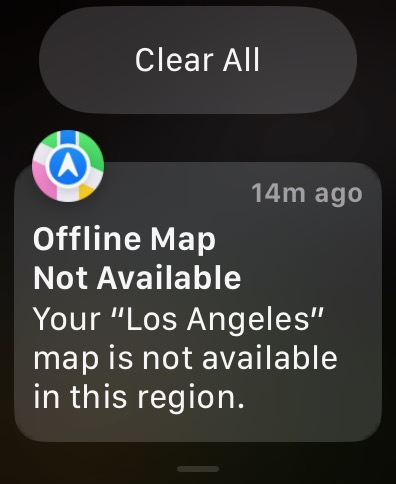
My offline map data for the Hong Kong and Macau region was available to me in Google Maps, but I neglected to set up offline maps in Apple Maps for the area. It was a good thing I had the Google ones, because despite having that roaming cellular reception, we couldn’t get either Maps app to work with live maps data, like to pull up reviews, or business hours. We did at least have addresses and our Google Maps Lists. Neither of us had ever experienced this before, but the second the ferry got back into range of Hong Kong cell towers everything was back to normal.
Hong Kong Disneyland

I’m convinced that Disney’s international apps are bad on purpose to make the US ones seem good in comparison. The Tokyo Disneyland app is terrible, even though Tokyo Disneyland isn’t run by Disney. The HK Disneyland app is bad even though Disney theoretically has ownership. The HK Disneyland app requires setting up a separate Hong Kong Disneyland account. It also uses Baidu for the interactive map of the park, so you either agree to let Baidu have access to your location data, or you don’t get the map. I elected not to get the map.
This is all immaterial though because nothing actually uses the app. Everything is done with QR codes. Your ticket, and any additional passes you purchase, are in PDFs. Every ticket taker and ride employee scans the various QR codes that you have. I couldn’t perceive any benefit to using the HK Disneyland app, or even bothering to download it. You might as well not have it.
We didn’t even need to know the ride wait times because nothing ever got busier than 35 minutes, and the park is so small you can easily do everything once in the morning before things even get that busy.
HK PhotoPass
Jason had booked early entry for the park, so we did the ride that seemed like would get the most crowded later first, the Frozen ride. There is a nice little drop in the water boat thing, and they take a picture. Not a foreign concept to theme park attendees at this point. They have a video wall where they show the photos of people from the ride, and you can pay extra for a photo pass. We made several incorrect assumptions that lead me to purchase the pass. We thought that other rides took photos —none did, not even the roller coaster. The only other use for the photo pass was to line up to take photos with characters, or to line up to take photos with the castle, or the Christmas tree. We didn’t want to do any of that so I really overpaid for one photo.
The other thing to know is that you have to download the HK PhotoPass app, and create another account. None of this stuff is linked! Fortunately, I’m using Hide My Email for all of it, but it’s really sloppy.
Translation
Both Apple’s Translate app, and Google’s app with its camera translation worked just fine. In contrast to the Japan trip, the translations from Traditional Chinese, and Simplified Chinese, both worked fine whenever either or both were present. We didn’t seem to have any peculiar idioms or expressions. This was, of course, probably aided by us not needing to rely on translation as much as we did Japan. It’s a former British colony so English is pretty pervasive in signage, and menus.
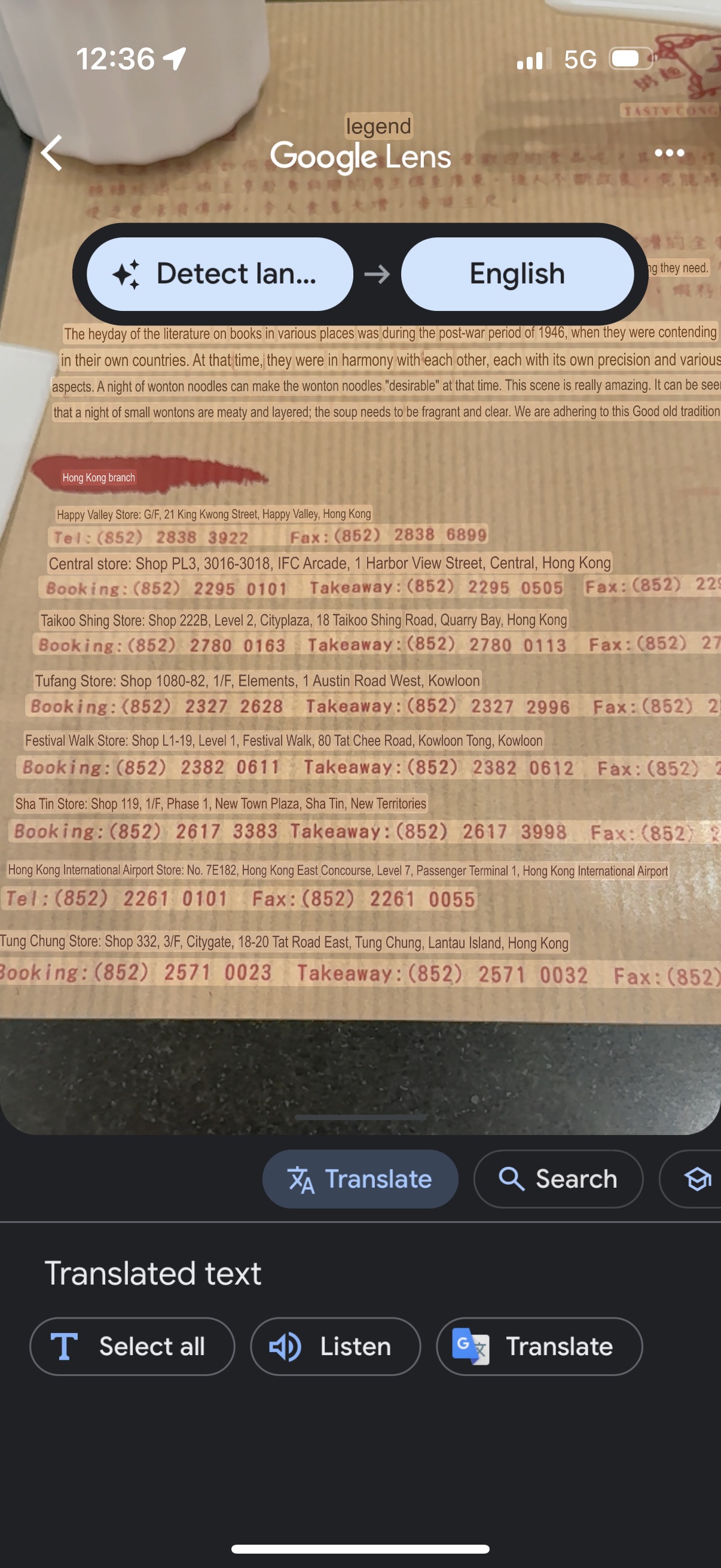
I still have a slight preference for Google’s app over Apple’s, but that’s a very unscientific preference. I do wish both saved their results to the camera roll though instead of needing to screenshot the translation I was seeing. Especially when you tap that “shutter” button.
Apple and Google also default to the text based Translation view when I open the app, even if I was last in the Camera view. If either remembered what I was doing the last time I used the app then I’d award 10 points for that.
iOS 18.2 wasn’t released until weeks after my trip, but I’m glad I didn’t install the beta expecting Visual Intelligence to do anything translation related, because it doesn’t.
Photos
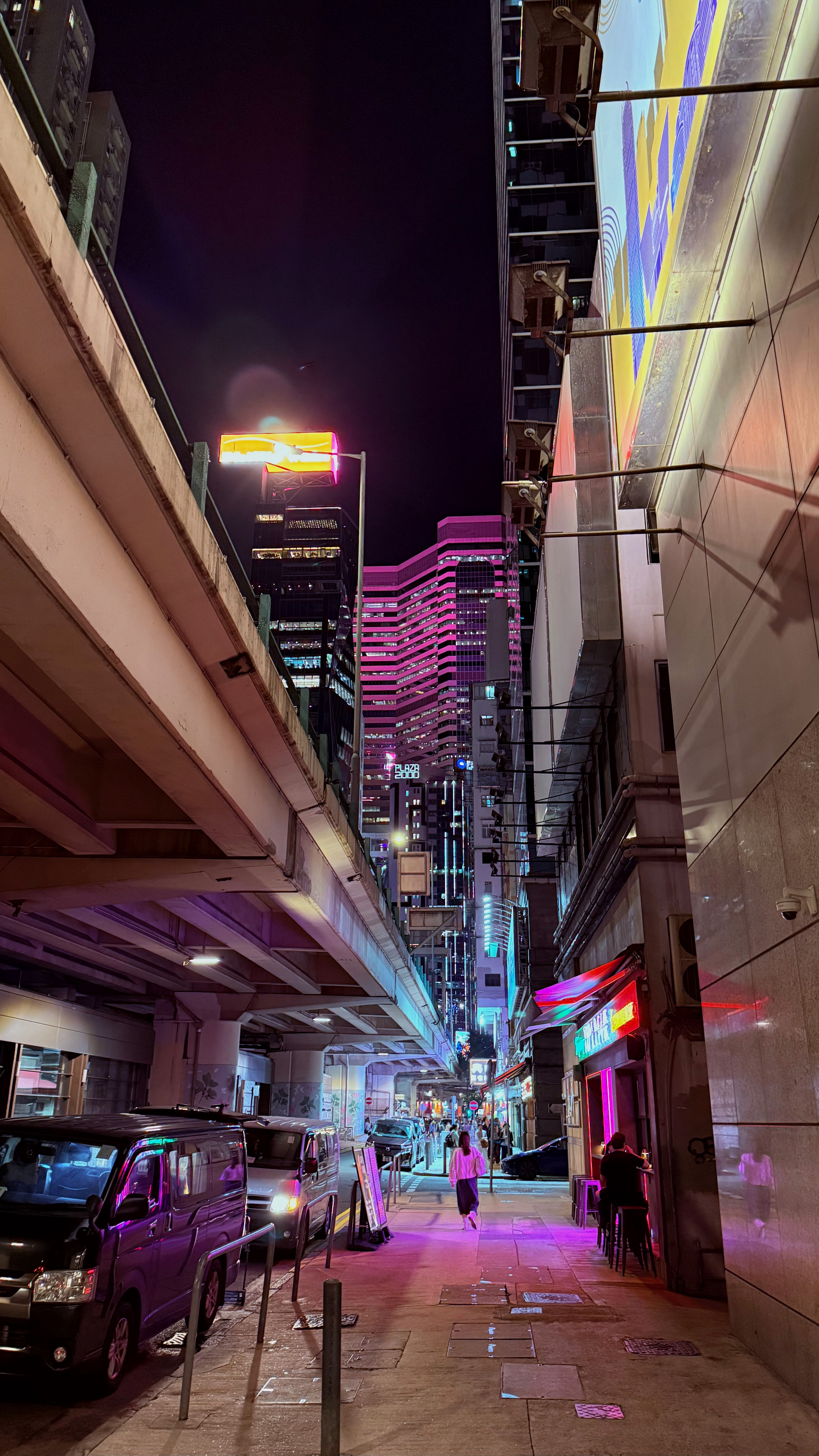
I’m still taking my Sony a6400 with me, and my Sigma 18-50mm lens, along with Rokinnon 12mm. I only really used the Sigma on this trip. The big thing that’s different is that I had an iPhone 16 Pro this time. That changed my photography quite a bit from the prior trips that all used my iPhone 13 Pro.
Camera Control had no impact on this trip, or how I use my iPhone whatsoever, but the ability to edit photographic styles after I take a photo did make a big difference. The iPhone’s default settings are too aggressive at tone mapping and evening things out. I have found that I generally prefer Amber, with a lower tone setting, but that’s not always true, and I don’t want to fiddle around with it while I’m take a photo.
HDR, Lightroom, and Instagram
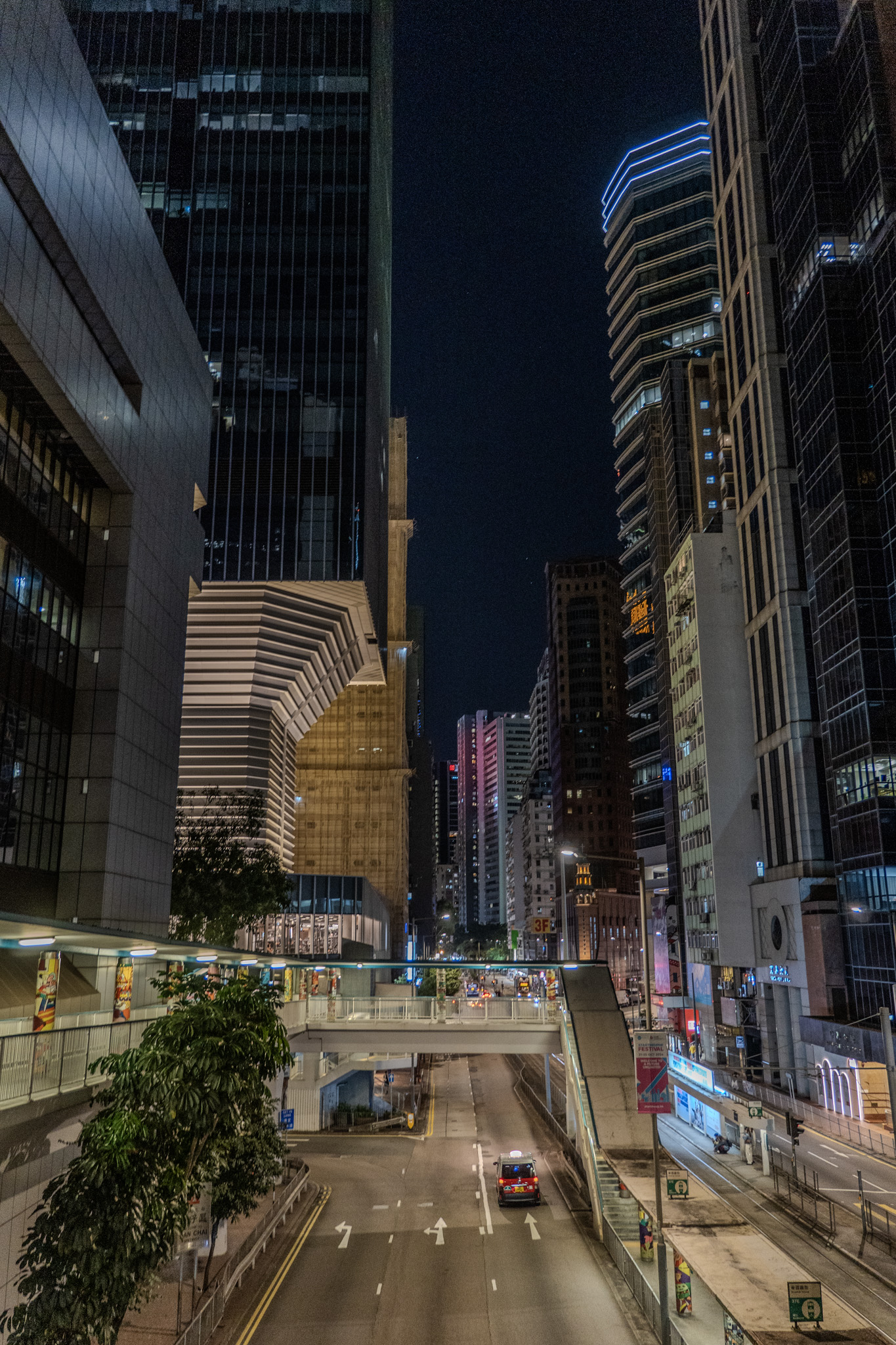
I mostly didn’t care about HDR output before the iPhone 16 Pro because everything was so even the highlights didn’t pop. You just had a generally bright image with more bright stuff. Bright with extra bright. Since I can get more contrast through the tone controls, and adjusting the various color settings, I can get more of a “pop” in HDR now with the iPhone 16 Pro than I felt like I was able to get previously.
Instagram also supports importing HEIC files, and if you mix and match HDR HEIC files with SDR files then you get odd-looking results.
This made me try to get HDR output from Lightroom again. Lightroom has supported HDR editing for a while, but the formats you can export to are not ones Instagram is friendly with. It can’t export to HEIC, but will export to tone mapped JPEG, JPEG-XL, and AVIF. I can get something exactly like I like it with HDR editing but then export it to (non-HEIC HDR Format Here) and Instagram will read it as if it was SDR. Which is better than what it used to do when it would render JPEG-XL and AVIF files as green and magenta streaks. Progress.
I’m not quite sure what to do about that because I do like to edit my photos in Lightroom’s iOS app. That’s not just out of habit, it really is actually a good editor. I even bought a USB-C to SD Card adapter to replace my Lightning one for this purpose.
Photomator
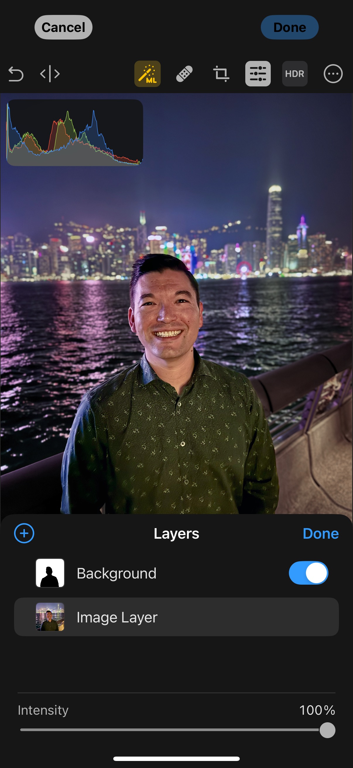
This is a strange time to get on the Photomator bandwagon, what with Apple recently acquiring it and all. It’s future as anything like the current app seems uncertain. However, I had downloaded it for the Clean Up comparison test video I made, and found myself giving it another try.
I’m a big fan of siloing things for different purposes, and I liked having my heavy camera raw files somewhere else (CreativeCloud Storage) instead of in my iCloud storage, mixed in with all my other photos of receipts and grocery store shelves.
This time around I found that I liked the iOS app more than the Mac app, once I figured out that there was a toggle to get it to handle HDR. This meant I could edit iPhone 16 Pro HEIC files with more precision than the Photos app without having to send them to Lightroom, and then back to my Camera Roll in a totally different format. It also meant when I uploaded them places it would be treated like the rest of the iPhone HDR photos.
I feel pretty certain that Apple will keep a standalone pro-editor of some sort that’s outside of Photos. It can do so much more than what people need (like the subject masks). I definitely see a case for selectively taking features and putting them in the Photos editor instead of what’s there now, but it would be overkill to do all of this.
Calculator
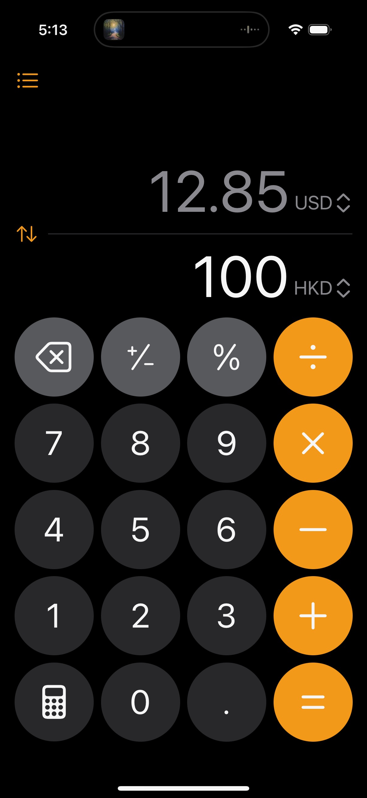
I am a huge fan of James Thomson’s PCalc, but there’s a new trick in the Calculator app I didn’t know about. It can handle currency conversion. I hadn’t heard anyone mention this in the Apple podcastoblogosphere, but my boyfriend told me about it because he saw it in an Instagram Reel. This was a huge help in Hong Kong because currency conversion is not the kind of thing I can do in my head easily, and I didn’t want to memorize the rate.
I didn’t actually use the Calculator app to calculate anything. It just sits in currency conversion mode now. That’s more use than the Calculator app’s seen in years from me.
Back Home
I’m always pretty anxious about traveling, but I do like to experience being somewhere new. I am greatly appreciative of any technological advances that alleviate some of the stresses travel can bring me. I look forward to doing more travel in the future.
Category: text